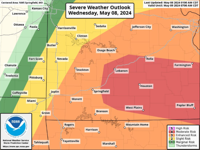
The National Weather Service released their latest information packet on the severe weather present in the Ozarks, and the risk level has increased from 3 to 4/5 for the overall severe weather outlook for much of the listening area.
The maximum risk area is focused mostly inside of the Missouri border from just south of West Plains, to as far north as Rolla, and extending east past Poplar Bluff. Primary risks in today’s storm include possible baseball-sized hail, and damaging wind gusts of up to 80mph. In addition, tornadoes may be possible in areas east of Highway 65.
Advertisement
Time frames put most of the storms happening anywhere between 10am to midnight.
DSS 5-8-24


