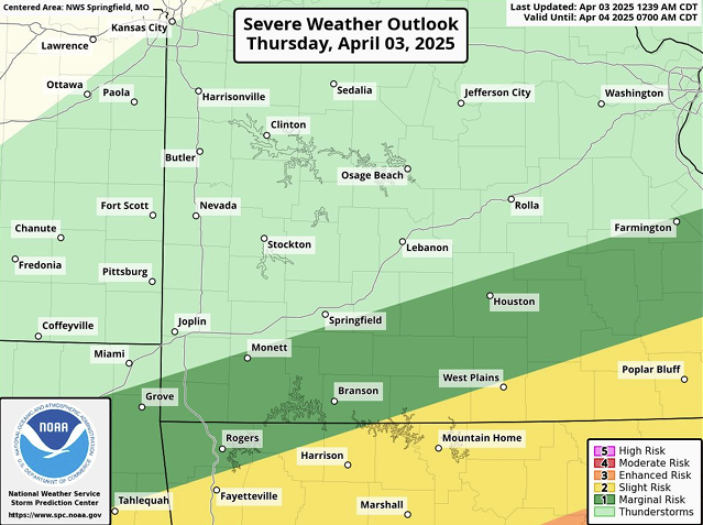
The first day of severe weather for this first week of April has ended, with lots of rainfall, hail, and a few tornado warnings being issued for large areas of the Ozarks. Today, we’ll receive a bit of a break in the level of severity, with increased risk again tomorrow along with high chances of flooding as we get closer to Saturday night.
The National Weather Service has assessed the risk for storms across most of the area today to be between 1 to 2 out of 5 for storm risks, with most of the listening area increasing to 2 or 3 out of 5 tomorrow. Risks of harzards today remain very low, however tomorrow, there could be golf-ball sized hail, 60-70mph winds, and a small risk or tornadoes.
Looking ahead, the entire listening area has been placed under a flood watch until Saturday evening, with increased chances of major flooding when looking further south and east. As of current, we are looking at least a 40% chance of rapid flooding through Saturday night.


