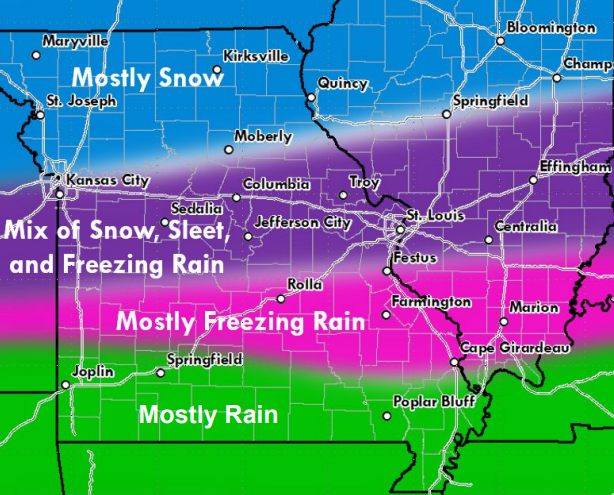
Regardless of where a listener falls within our primary listening radius, many people are closely monitoring the approaching winter storm that is likely to impact travel toward the end of this weekend. The National Weather Service in Springfield has released their latest forecasts on the incoming weather, and we’ll go over the details with you.
As of roughly 4:30am this morning, a winter storm watch is in effect, with the highest areas of impact being sections of Wright, Texas, and Shannon Counties, and locations further north. Counties south of these areas are expected to receive mostly rain, but could still see some degree of freezing rain. This time frame for this storm is anywhere between the hours of 6pm Saturday, through to 6am on Monday.
Those who reside in the northern sections of those three outlined counties could see snow and sleet accumulations of 2 to 4 inches, and ice accumulation of around one tenth to a quarter-inch. The possibility of snow also exists in a slightly larger area that those outlined above. The possibility of a glaze of ice covers nearly our entire listening area.
Another aspect of this winter storm to keep in mind are the extreme wind chill effects as a result of the arctic air moving through. Much of the listening area can expect wind chills of around 0 to 5 degrees, with some northern locations possibly experiencing wind chills reaching -10.
The entire information packet will be included below for individual review.
DssPacket - Fri Jan 3 429 AM


