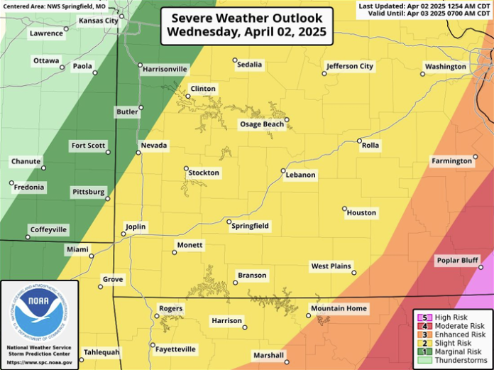
The National Weather Service in Springfield has released their latest information packet about this weeks severe weather. The ideas in the packet are summarized below.
The greatest levels of concern lie to the East of our broadcast area, with a maximum level of 5/5 risk for severe weather taking place in Poplar Bluff. West Plains currently lies right on the edge of the 3/5 risk range, with everything north and west of West Plains being in a 2/5 risk.
The greatest hazard expected today are hail, and damaging wind, with tornadoes being a small possibility for most of the listening area. Maximum size expected for hail is golf-ball sized.
The timing for these weather events mostly lies in the 12pm to 6pm range for the area.
Past today, flooding remains a serious concern, with the entire listening area being in a flood watch until Saturday evening. Those close to rivers, including the Current and Jacks Fork, should prepare in advance for water levels to rise rapidly.
In addition, a tornado watch has been put into effect for the entire area until this evening, with Meteorologist Kelsey Angle from the National Weather Service in Springfield outlining the watch.
Audio Player


